

A few weeks ago, we asked MinnPost readers on social media to share what they wanted to know about transportation in Minneapolis and St. Paul. Dozens of bicyclists, drivers and Metro Transit riders flooded us with questions. We published a few of those questions, with answers, last week— covering topics from speed limits to the status of bike sharing in St. Paul.
But we had so many questions that we’re back for round two, this time exploring everything bike-lane etiquette to bus rider complaints:
What’s the status of the Nicollet Avenue streetcar? —Alex Schieferdecker, Philadelphia
The city of Minneapolis’ plan for a 3.7-mile streetcar on Nicollet and Central avenues isn’t exactly dead. But it also isn’t progressing through the bureaucracy of transportation planning either.
Initial planning for the transit line began in 2007, under former Mayor R.T. Rybak. Using the Hennepin Avenue Bridge to cross the river, city planners mapped the streetcar to run from Central Avenue and Southeast Eighth Street in Marcy-Holmes to the intersection of Nicollet and Lake Street, which is currently blocked by a Kmart. Early studies showed the line would cost upwards of $200 million in construction and another $10.6 million to operate each year, while providing 9,000 trips daily and a new north-south connection between light rail lines.
In 2010, the Minneapolis City Council agreed that it wanted to explore not just a Nicollet-Central line but a multi-line network across the city. The Federal Transit Administration answered local leaders’ funding request to study the transit option with a $900,000 grant, which helped pay for numerous environmental assessments and reports estimating a streetcar’s impact on the housing market and economy.
Three years later, the council successfully lobbied the state Legislature to establish a special tax district surrounding the Nicollet-Central route, so the council could levy property taxes from new buildings along the route and raise money for streetcar construction.

[image_credit]City of Minneapolis[/image_credit][image_caption]A rendering shows how a streetcar might look in northeast Minneapolis.[/image_caption]
In an interview last week, public works director Robin Hutcheson said a team of city staffers is studying travel patterns along the Nicollet-Central corridor so that it has documented proof of the need for new transit investments there. When the city eventually decides what it wants to build — a streetcar or other type of transit option — it can use the new data in its requests for federal funding.
“We wanted it [the streetcar plan] to go through the federal funding process, but there’s a lot of steps to that that have become pretty time consuming,” Hutcheson said.
And though a possible streetcar is not off the table of options for now, Hutcheson emphasized that travel patterns and development have evolved significantly since Minneapolis leaders began discussing the transit mode more than a decade ago. More recently, Mayor Jacob Frey has expressed skepticism that the streetcar project will come to fruition, though Council President Lisa Bender, whose ward includes the southern end of the proposed line, has voiced support for the concept.
“We’re starting to be more assertive about moving a project forward on the corridor sooner rather than later,” Hutcheson said, without going into specifics. “We know that it’s just been too long since we’ve been able to implement something.”
After analyzing travel patterns this year, she said the team will use its findings to guide a public conversation about redeveloping the corridor with new transportation. “I’m more optimistic now at our ability to accelerate the work,” she said.
What is the discipline process for Metro Transit drivers who endanger lives with lawless driving? —Ward Rubrecht, South Minneapolis
According to Metro Transit, a team of customer relations workers field complaints against bus drivers (or other aspects of the transit service) via social media, phone calls, emails and online forms.
Passengers filing the reports must include the incident’s date, time, location, route and other information to help the customer-relations staff track down evidence and investigate the claims, according to Metro Transit spokespeople. That evidence can include GPS data that show where and when buses traveled, video footage of Metro Transit property or interviews with bus drivers and passengers to learn more.

[image_credit]MinnPost file photo by Corey Anderson[/image_credit][image_caption]Nicollet Mall Metro Transit bus to Northtown[/image_caption]
The spokespeople did not provide any additional information on the complaint process or subsequent investigations.
(In the case of emergencies, Metro Transit advises people to use its Text for Safety tool, 612-900-0411, to report suspicious activity or crime that’s an immediate threat to their safety.)
Minneapolis’ Complete Streets policy directed Public Works to look at traffic light timings and to reprioritize them for pedestrians years ago. What’s taking so long? —Janne K. Flisrand, Lowry Hill
About 85 percent of all car-pedestrian crashes in Minneapolis occur at intersections with traffic lights, data show. Vineland Place and Lyndale Avenue near the Walker Art Center, 27th Street and Cedar Avenue in the Phillips neighborhood and Third Street North and Second Avenue South downtown are among hotspots for severe collisions.
The 2016 Complete Streets Policy establishes pedestrians as the city’s top priority in its transportation planning and is part of a broader plan for safety improvements, called the Minneapolis Transportation Action Plan. Essentially, that means the Complete Streets Policy is a set of values that the city wants carried out throughout all aspects of policy making in coming decades. And, yes, it includes a section on signal timing.
It reads: “The operation of the public right-of-way is a significant opportunity to implement the City’s modal priority framework that prioritizes people as they walk, bicycle, and take transit. The timing of traffic signals will reflect this modal priority framework, such that signal timing plans will incorporate multimodal metrics. Ongoing monitoring and evaluation of the operation of the public right-of-way should support safe, comfortable, and convenient travel for people that choose to walk, bicycle, take transit, or drive a vehicle.”
In other words, the city promised to make sure its computer-run system for traffic signals gives people walking or biking on the streets — not drivers — priority.
And according to Hutcheson, the city is adhering to that vow. She said crews do on-the-street reconfigurations of signal timing where there are issues (people can report signal problems by calling 311), and a team at the city’s traffic operation center monitors camera footage of streets to adjust signals intersection-by-intersection based on real-time traffic conditions. “We are constantly monitoring and adjusting traffic signal timing every single day,” she said.
Hutcheson said staff at the operations center may shift the timing of a light cycle to give drivers more green time in areas of traffic gridlock. They use federal standards as minimums for pedestrian crosswalk times, she said, which vary by the width of intersections across the city.
But with the incremental changes comes the need to reconcile the system on a citywide basis, Hutcheson said. Every two to five years, the city undergoes a comprehensive evaluation of its timing system and rolls out big-picture operational changes. The next analysis of that kind will happen soon, she said, considering traffic engineers’ concurrent effort to lower speed limits.
“No matter what, we’re going to have to do some signal timing changes,” Hutcheson said. “We’ll have to do an overhaul.”
How much faster do bus-only lanes make buses? —Jonathan Foster, Minneapolis
Following cities such as Washington D.C. and Los Angeles, Minneapolis installed bright red, bus-only lanes in several areas of the city this summer: southbound Chicago Avenue (from East 28th Street to the Chicago/Lake Transit Center), northbound of Hennepin (between Lake Street and the Uptown Transit Station) and southbound from 25th to Franklin Avenue. In coming weeks, the city will test a bus-only lane between Lake Street and Franklin Avenue on Nicollet Avenue as well.
On Hennepin Avenue, only buses can use the northbound lane between 7 and 9 a.m. on weekdays, which means vehicles can’t park there. Then, during the evening commute between 4 and 6:30 p.m., the same rules apply for the avenue’s southbound bus-only lane. The rationale for bus-only lanes is that by giving buses their own space on the road — clear of drivers making turns or changing lanes — passengers will get from stop A to stop B faster.
Hutcheson said while the city and Metro Transit are still studying the full effects of the new bus-only lanes, a pilot project on Hennepin Avenue last year cut passengers’ travel times by 20 percent during commuter hours, according to the public agencies. That means a typical 45-minute commute was 36 minutes with the new design.

[image_credit]MinnPost photo by Jessica Lee[/image_credit][image_caption]On Hennepin Avenue, only buses can use the northbound lane between 7 and 9 a.m. on weekdays, which means vehicles can’t park there.[/image_caption]
Studies of bus-only lanes in other cities show similar results. For example, in Arlington, Mass., a dedicated bus lane cut riders’ trips by up to 10 minutes, according to Boston-area transit advocates.
Supporters say those faster, smoother trips are key in boosting transit ridership in the Twin Cities metro. Considering the success so far, Hutcheson said Minneapolis will test even more red, bus-only lanes in different parts of the city over the next 18 months. But, at this point, the new lanes’ locations are unclear.
Are bikes welcome in Minneapolis’ new bus lanes? —Stephen Potts, Minneapolis
Technically, no, bikers are not supposed to use the red lanes during commuting hours, just like drivers. But it’s a pretty loose rule. Rather than citing bicyclists for the violation, the city is observing the behavior — studying where and what times of the day cyclists use the bus-only lanes. “We’re going to evaluate,” said Hutcheson. “It’s interesting to see when you make space like that how people choose to use it.”
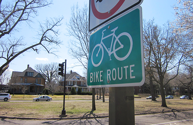
Can cars stop or park in bike lanes for any amount of time? When should cars come over into the bike lane to turn? And what are the rules about vehicle vs. bicycle-pedestrians right of way at all intersections, striped and un-striped? —Peter Schmitt, Minneapolis
Per state law, “no person shall stop, stand, or park a vehicle” in bike lanes except for when signs permit otherwise, motorists can use the lanes to avoid a crash or police pull someone over. A ticket for the violation is $37.
But enforcing the rule is a challenge, according to Hutcheson. In Minneapolis, the Regulatory Services department fields complaints, and often staff can’t respond to cases fast enough to cite offending vehicles. “It’s difficult because somebody will call 311 and a traffic-control agent will head right over,” said Hutcheson. “But if it’s a delivery truck, it may have moved by now. So, I think this is something that we want to work on.”
Enforcement could increase, though. As part of Mayor Jacob Frey’s citywide funding plan, he wants to create a new “Accident Reduction” unit within the police department to monitor for law breakers on the road, which would include drivers illegally using bike lanes. The Minneapolis City Council has yet to approve the proposal, which would create three new positions for traffic enforcement officers.
As for drivers using bike lanes to turn, state law does not provide a clear-cut formula for when motorists should cross the lanes, but it does require drivers to use their turn signals prior to changing lanes, yield the right-of-way to bicycles and use their best judgement for safety.
[image_credit]MinnPost photo by Corey Anderson[/image_credit][image_caption]Per state law, “no person shall stop, stand, or park a vehicle” in bike lanes except for when signs permit otherwise, motorists can use the lanes to avoid a crash or police pull someone over.[/image_caption]
Bicycles, on the other hand, are legally “vehicles” under state law, which means cyclists must obey the same rules as motorists at intersections. That means people on bikes are supposed to yield the right-of-way to pedestrians and give audible signals before passing them.
I’m excited that cities can set some speed limits now, but how about turns on red? Is there any chance there will be a shift to no turn on red? —Grace Riley, St. Paul
Already, the city has prohibited right turns on reds at some intersections based on their travel patterns and crash history. And while Hutcheson said they will continue to make the change on a case-by-case basis, a citywide ban is not in the cards.


To be clear, I asked my question because the streetcar is a terrible idea. It would provide a less reliable service than aBRT, for a cost that is several times greater.
But the ghost of the streetcar plan is currently holding up planning for a much-needed Nicollet-Central aBRT bus. I hope when Director Hutcheson refers to “moving a project forward on the corridor sooner rather than later,” she is thinking about working with Metro Transit to prioritize this aBRT route that would instantly become the city’s most used.
I believe bikes use bus lanes in Montreal. it seems to work well. buses are less frequent and drivers are better than the general public.
Instead of a street car, how about much less expensive aBRT, preferably with bus only lanes?
Physical barriers (like the new ones on 3rd Ave and the curb-protected lanes on Oak and Plymouth) seem like a good way to keep people from stopping and parking in the bike lane. Or grade-separated cycle tracks.
Here’s a question: the 35W route through Minneapolis – wasn’t most of that torn up and rebuilt ten years ago for $500 million or so? Now that it is all torn up again, I guess my question is, is MNDOT a magic place where anything goes and nothing matters, where there is no accountability and no decisions can be questioned?
Different parts of 35W, no? Wasn’t that all south of 46th Street and this is north of 46th?
I was wondering where the street car had got to. Shouldn’t they focus on the segment from downtown to uptown before they try to bridge the river?
The answer to the right turn on reds question is disappointing, especially consider that last month, the Institute of Transportation Engineers rescinded their recommended practice for Right Turn on Reds due to safety concerns. – https://www.ite.org/pub/?id=B59F0054-B3AE-FD5C-81E5-62E18920B5DC
“…That means people on bikes are supposed to yield the right-of-way to pedestrians and give audible signals before passing them.”
Speaking as a daily pedestrian in Minneapolis for the past ten years, I’ll just say that this has not been my experience in encounters with cyclists. Over the course of thousands of encounters, I can count on my fingers (with a few left over) the number of times a cyclist has provided an audible warning that s/he was about to pass me, and while encounters at intersections have been far less frequent, I’ve NEVER seen a cyclist yield the right-of-way to a pedestrian at an intersection.
I do it all the time. Most of the time, the pedestrians still can’t cross because there is a steady stream of cars who aren’t yielding. Often, the pedestrians look at me funny or tell me to go ahead.
I’m disappointed that the response on traffic signal timing references only drivers, and doesn’t acknowledge the different needs of people walking, rolling and biking. We need to have a larger discussion, and prioritizing me when I bike or walk would mean shorter signal cycles, universal countdown timers that start the moment the light turns, slower speeds, and fixing the new “bike” signals (on Washington Ave, along the Hiawatha Trail crossing 26th) to recognize how people on bikes experience streets rather than applying car-engineered traffic signal standards to bikes.
I want to cross more quickly, and it’s unpleasant to stand and wait in the rain and the cold temperatures for very long traffic signal cycles. It’s also stressful to stand inhaling exhaust with drivers whipping by at 40mph, or worse zooming a bit too close around the corner where I’m standing.
I wrote about my personal experience of this in 2015 at the intersection I cross more than any other. https://streets.mn/2015/11/24/signal-timing-transformed-my-everyday/
I also appreciate predictability. If I know it’s only 4 seconds until the light turns, I patiently wait. Or, at 5am with no traffic visible in either direction and 40 seconds to wait, I can make an informed decision about crossing against the light (although shorter signal cycles would avoid that, too).
As both a pedestrian and a driver, I am puzzled by the signal timing along Hennepin Avenue. They all ought to be green at the same time or red at the same time.
I dread going through Uptown in the early evening (although I have to a couple of times a week) because the light at Lake and Hennepin may be red while the one at 31st and Hennepin is green, but because there are so many cars filling the block in between, the cars with green at 31st and Hennepin can’t move forward.
Then, when they make it to Lake and Hennepin after two light cycles, they are stymied by cars turning left off Lake Street onto Hennepin. This is true whether you’re in a car or on a bus.
A similar situation occurs at the notorious Lyndale-Hennepin bottleneck on nights when there are Twins games in towns. (I no longer have to take that route, thank goodness.) Drivers on either Lyndale or Hennepin get the green light only to find that there’s a red light at Groveland, a street that gets much less traffic than either Lyndale or Hennepin and often has none. It has taken me as long as 20 minutes to get through that intersection.
Whoever is in charge of traffic lights needs to take a serious look at timing. What’s the use of a green light on a heavily traveled street when there’s a red light at the same time only a block ahead?
“In an interview last week, public works director Robin Hutcheson said a team of city staffers is studying travel patterns along the Nicollet-Central corridor so that it has documented proof of the need for new transit investments there.”
All they have to do is ride a Route 18 bus. It is almost always standing room only.
There I did their study for them.
Problem is that a streetcar is just a bus put on rails in traffic, which means it is as slow as the slowest traffic. It also stops really frequently, which means it is going to be really slow. Much better to put limited stop buses with signal preemption and other transit advantages. Much better for ridership.
5% of Americans use Twitter every day. 80% of Twitter posts come from 10% of users. 66% of Twitter posts appear to be from bots. Twitter users are significantly younger, wealthier and whiter than the general public. (Pew) When reporters user Twitter to define what they are going to talk about, they don’t reflect what the general public is interested in. Had other tools been used, I expect this article would have been significantly different.
Although secret, it is possible that the shipment of high level radioactive waste from University of Saskatchewan on August 7 traveled through the Twin Cities in the dark of night. I raised this issue at Congresswoman McCollum’s town hall meeting in Stillwater Wednesday night. What local authorities were notified: Keith Leuer Public Safety Director should have received a ten day notification of this intrusion. What action was taken to protect counties along the way and protect drivers from emitted gamma rays. What is the plan for First Responders: do they have robotic equipment or are we asking them to risk nuclear radiation? I have a copy of the permit to ship.